



NASA depicts Crimea as "Russian" during live broadcast of solar eclipse in Europe. PHOTOS
The National Aeronautics and Space Administration (NASA), during a live broadcast of the total solar eclipse on 12 August, displayed a map that visually depicted temporarily occupied Crimea as "Russian."
This is evident from footage from the 12 August solar eclipse broadcast, Censor.NET reports.
Details of the incident during the astronomical broadcast
On the evening of 12 August, NASA held a live broadcast dedicated to the passage of the solar eclipse over Europe and the Atlantic. While displaying a global map tracking the movement of the shadow, the broadcast organisers used graphics in which national borders were shown in line with Russian claims.
A closer examination of the broadcast footage shows that Crimea was visually depicted as "Russian" and graphically separated from the rest of Ukraine.
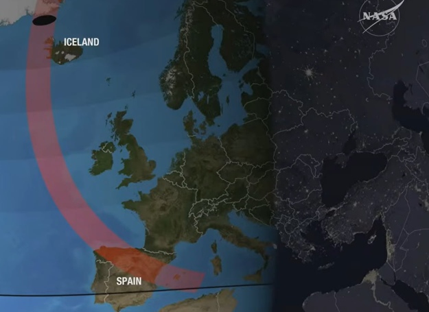
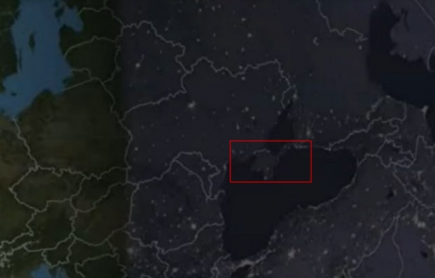
No official explanation or apology has yet been issued by the US space agency.
Other similar controversies
The incident has joined a long list of cases in which global brands, governments and media outlets have made similar mistakes:
- In 2018, the authoritative British newspaper The Times had to issue an official apology for publishing a map depicting Crimea as "Russian";
- In 2021, following official appeals from Ukraine’s Ministry of Foreign Affairs and public attention, the US corporation Apple corrected the maps in its Apple Music for Artists app;
- In 2023, a map depicting the occupied peninsula as part of Russia was used in a propaganda video released by the Hungarian government;
- In 2025, US broadcaster CBS displayed a map of Ukraine without Crimea altogether, although the other occupied territories in the south and east were shaded correctly.


