Chonhar Bridge after AFU strikes: damage and pontoon crossing recorded. SATELLITE PHOTOS
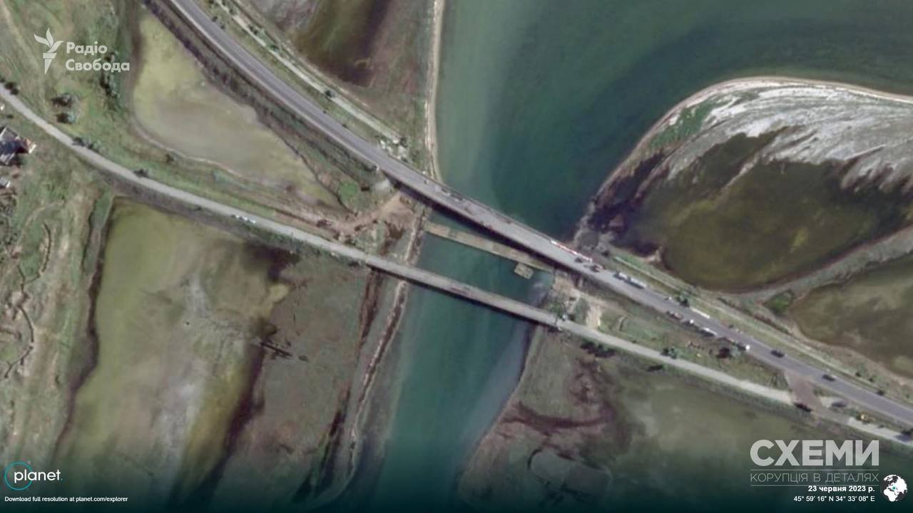
A satellite has recorded dark strike marks in the central part of the Chonhar Bridge, which connects the temporarily occupied territory of the Kherson region with Crimea.
Censor.NET reports this, citing a photo published by Radio Liberty's Schemes project.
Details of the strike
Planet Labs satellite images available to journalists show the aftermath of the AFU attack on the night of June 7. In particular, they show dark marks from strikes in the central part of the bridge, as well as a pontoon crossing deployed nearby.
On June 7, the occupiers reported that they had been forced to block traffic due to the bridge being hit by Ukrainian drones. This bridge is an important supply route for the Russian army and is used to support the Russian grouping of forces in the south.

Background
- The 475th Separate Assault Regiment of the Ground Forces of the Armed Forces of Ukraine, CODE 9.2, reported that, together with pilots of the 1st Separate Assault Regiment named after Dmytro Kotsiubailo, it had struck the bridge "using assets from Fire Point and Begemot UAVs."
At the same time, Schemes' analysis of satellite images from previous years indicates that the Russian military had likely prepared in advance for Ukrainian strikes on this bridge. A pontoon crossing first appeared near the Chonhar Bridge back in June 2023. Later, it could be seen hidden beneath it.
On June 9, the bridge once again came under attack by the AFU, but there are currently no satellite images of the strike.