Satellite images of aftermath of AFU strike on Russian airfield "Lipetsk" are published. PHOTO
Planet Labs satellite imagery from 9 August shows the aftermath of Ukrainian military strikes on the Lipetsk airfield, located near the city of the same name in Russia.
This was reported by Censor.NET with reference to photographs available to the Schemes project of Radio Liberty.
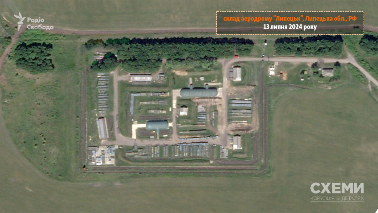
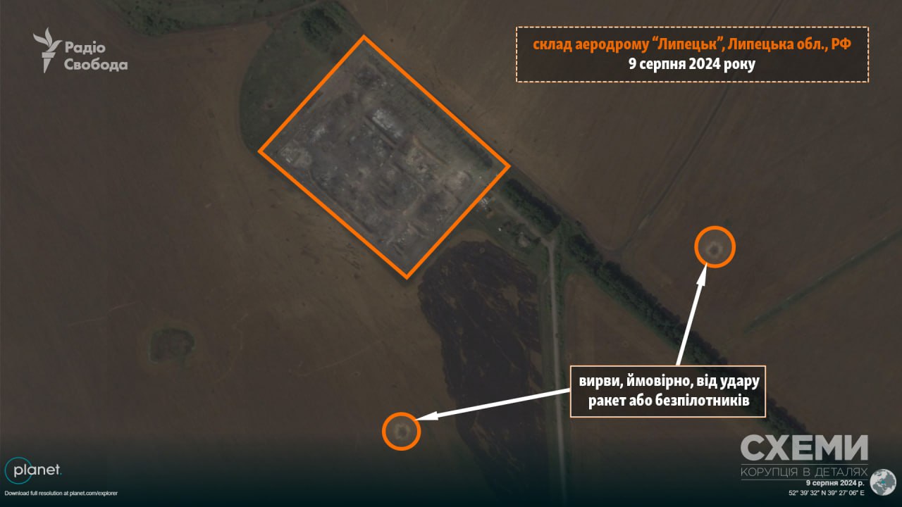
As noted, Planet Labs satellite imagery of 9 August, which is available to "Schemes", shows the aftermath of Ukrainian troops' strikes on the Lipetsk airfield near the city of the same name in Russia.
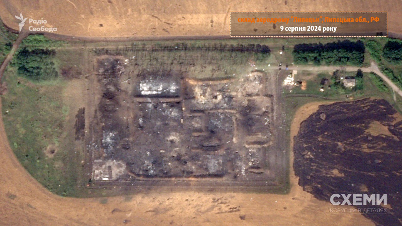
As can be seen in the images, a number of buildings on the airfield, which could have been used as warehouses, have been completely destroyed and a large-scale fire is likely to have been going on. Two shell craters can also be seen on the ground, which could be the result of missiles or drones used by the Ukrainian armed forces to launch strikes.
Ukrainian Armed Forces strike at Lipetsk airfield in Russia
According to the General Staff of Ukraine, during the attack on the night of 8-9 August, Ukrainian troops hit Russian warehouses with guided bomb units and a number of other facilities near the Lipetsk airport. In particular, one radar of the S-350 anti-aircraft missile system was destroyed, the General Staff said. The ministry also noted that units of the Missile Forces, Special Operations Forces, the Security Service of Ukraine and the Unmanned Systems Forces of the Armed Forces of Ukraine took part in the military operation.
In the morning, Radio Liberty journalists, citing an informed source, reported that several dozen fighter jets and helicopters were stationed at the Lipetsk airfield, as well as warehouses with more than 700 guided bomb units.
Earlier, on 9 August, the authorities of the Lipetsk region of the Russian Federation reported an attack by drones, and the Russian Ministry of Defence reported the downing of 19 of them.