The advancements and activities in satellite technology have become a pivotal part of global security and military strategies. Recently, Russia utilized satellites to capture images of a U.S. airbase in Saudi Arabia, just days before an attack on Iran, showcasing the strategic significance of satellite imagery. Meanwhile, the EU, aware of potential threats, has developed responses to defend its space assets against Russian attacks. Additionally, NATO has expanded its satellite surveillance capabilities to monitor Russia's military actions, illustrating satellites' role in global defense. Innovations in satellite communications, like the agreement between Ukraine's Ministry of Defense and NATO, demonstrate the growing importance of satellite technology in enhancing military and situational awareness capabilities.
What is the significance of Russia capturing satellite images of US bases?
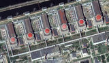
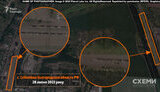
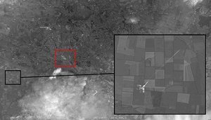
Russia's capturing of satellite images of a US airbase in Saudi Arabia highlights the growing use of satellite technology for military strategies and intelligence gathering. This action raises concerns about global security, as it underscores the capabilities and intent of nations to employ satellite imagery in potential conflicts.
How does the EU respond to satellite-related threats from Russia?
The European Union is aware of potential threats to its space assets from Russia and has developed tools to detect and deter such attacks. The EU's proactive approach in addressing these challenges emphasizes the importance of safeguarding satellite infrastructure and maintaining secure communication channels.
What role do satellites play in NATO's surveillance capabilities?
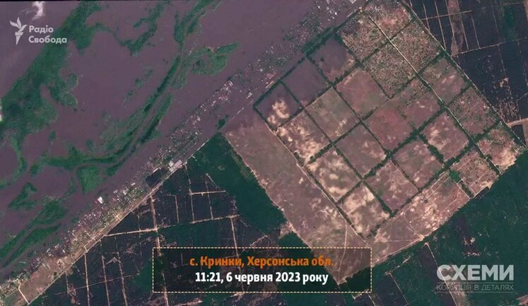
NATO has expanded its satellite surveillance capabilities to enhance its ability to monitor military movements, particularly in regions affected by conflict or tensions. By utilizing satellite technology, NATO can gather valuable intelligence and respond effectively to potential threats, thereby contributing to overall regional stability and security.
How are satellite advancements benefiting Ukraine's defense strategies?
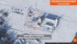
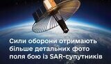
Through agreements with organizations like NATO and collaborations with tech companies, Ukraine has improved its defense capabilities using satellite technology. These advancements provide Ukrainian forces with better communication and situational awareness, enhancing their ability to manage combat operations effectively.
Why is satellite technology a crucial aspect of modern military strategies?
Satellite technology is integral to modern military strategies due to its ability to deliver real-time intelligence, monitor global activities, and provide secure communications. These capabilities allow for timely decision-making and strategic planning, making satellites a vital component in maintaining national security and defense readiness.